The main instrument for manually mapping large-scale topographic maps on the surface of a flat-panel meter. Electromagnetic Wave Ranger An instrument that uses an electromagnetic wave to carry a ranging signal to measure the distance between two points. The following small series introduces the relevant knowledge of engineering measuring instruments.
What are the common methods and instruments for engineering measurement?
First, elevation measurement
The elevation measurement mainly includes level measurement and trigonometric level measurement.
Leveling uses the horizontal line of sight to measure the difference in height between two points. Due to the high accuracy of leveling, it is the most important method in elevation measurement.
Triangulation is the measurement of the horizontal distance between two points or the slope and vertical angle (ie tilt angle), and then use the trigonometric formula to calculate the height difference between the two points. Trigonometric leveling is generally less accurate and is only used under appropriate conditions.
The following mainly introduces the basic methods and instruments for leveling.
1. The basic method of leveling
2. Level indicator
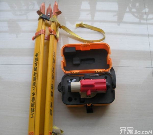
Slight tilting level The DS3 type tilting level used in general leveling consists of the following three main parts:
Telescope - it can provide sight and can read out readings in the far level ruler.
Level - Used to indicate whether the instrument or line of sight is in a horizontal position.
Pedestal - used to level the instrument, it supports the upper part of the instrument and enables the upper part of the instrument to turn horizontally
Automatic leveling instrument
1. Principle - A compensator is added to the light path of the telescope.
2. Use - after the flattening, the observation warning window in the telescope should all be green; the best state is the triangle spire and horizontal index line of the indicator window
3. Calibration - to add a test of the compensator, that is: turn the foot spiral, destroy the rough level, see if the warning indicator window appears red.
Electronic level
The level gauge used with the electronic level is a bar-coded ruler, usually made of glass fiber or indium steel. In the electronic level device is equipped with a line sensor, which can identify the bar code on the leveling scale. After the electronic level is ingested into a bar code, it is converted into a corresponding number by the processor, and through signal conversion and dataization, the midline reading and the line of sight are directly displayed on the display screen.
Second, the angle measurement
The instruments for angle measurement are mainly theodolites and are divided into optical theodolites and electronic theodolites.
Optical theodolite
The horizontal and vertical dials of the optical latitude and longitude are made of glass, and equally spaced sub-dashed lines are drawn on the edge of the periphery of the dial plane. The central angle of the two adjacent sub-line spacings is called the dial. The grid value, also known as the minimum grid value of the dial. The accuracy is generally determined by the size of the grid value, which is divided into:
DJ6 degree grid value is 1° DJ2 degree grid value is 20' DJ1 (T3) degree grid value is 4'
According to the precision from high precision to low precision points: DJ07, DJ1, DJ2, DJ6, DJ30, etc. (D, J are the initials of the earth and theodolite respectively)
Electronic theodolite
Electronic angle measurement principle
Electronic angle measurement is still performed using a dial. Unlike optical angle measurement, electronic angle measurement takes electrical signals from special format dials, converts them into angles according to electrical signals, and automatically outputs them in digital form, displayed on electronic display screens, and recorded in storage. Device. The electronic angle measuring disk can be divided into a grating disk angle measurement, a coded disk angle measurement, and a wire grid angle measurement according to different ways of obtaining electrical signals.
Soka Electronic Theodolite
South Electronic Theodolite
Third, the distance measurement
Distance measurement is divided into steel ruler measurement, line-of-sight measurement and photoelectric distance measurement.
1. Steel ruler measurement
In the formula: n—the number of full-scale segments; l—the length of the steel ruler (m); q—the excess length (m) which is less than one full metre.
2. Line of sight measurement
Theodolite sight distance measurement is a traditional indirect measurement method of horizontal distance and height difference. Tools used: theodolite and line-of-sight rulers
3. Optical distance measurement
Fourth, coordinate measurement
One of the main tasks of engineering surveys is to measure or stake out the three-dimensional coordinates of a space point. The instruments used are mainly total stations and GPS receivers.
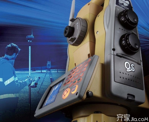
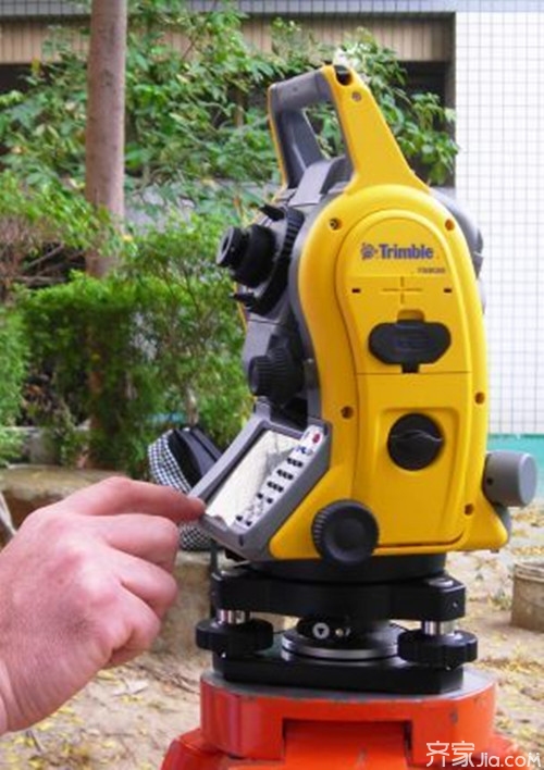
Total station
The main features of the total station (continued)
Flat angle, vertical angle and slant distance are automatically displayed, and the coordinates, elevation, and horizontal distance of the mirror station are automatically calculated;
Various data recording and storage modes: memory, PCMCIA card, serial communication;
Automatic compensation for horizontal and vertical angles;
Perform meteorological corrections and instrument constant corrections on distances;
Provide digital or graphic electronic bubbles for leveling;
Laser Pointer;
The basic steps of coordinate measurement
(1) Set the three-dimensional coordinates of the station point.
(2) Set the coordinates of the backsight point or set the horizontal dial reading of the backsight direction to its azimuth. When setting the coordinates of the backsight point, the total station will automatically calculate the azimuth of the backsight direction and set the horizontal dial reading of the backsight direction as its azimuth.
(3) Set the prism constant.
(4) Set the atmospheric correction value or air temperature and pressure value.
(5) The instrument height, prism height, and total station input.
(6) Sight the target prism, press the coordinate measurement key, the total station starts to measure distance and calculate the three-dimensional coordinates of the displayed measurement point.
Introduction to various total stations
Longer range: no prism ranging up to 400M;
Faster Ranging Speed: Ranging speed is measured twice faster than similar products;
Longer battery life: advanced power management system, saving more than 30% power;
More user-friendly design: SD card storage function, automatic temperature and pressure sensor;
Better water resistance: waterproof grade IP55.
SET220K . SET320K . SET520K . SET6120K SET10K series of total station has a lightweight body, full-featured features, with backlit full digital keyboard to make the operation more convenient, in a variety of engineering and measurement work has a wide range of uses. Double-sided with backlit full digital keyboard makes data input more convenient (SET620K is a single-sided keyboard). ? Universal and efficient measurement software, IP66 high level of dust and water resistance. Application stakeout measurement, road calculation and stakeout, alignment measurement, assembly and positioning of concrete components, construction engineering control, area measurement, and deformation monitoring.
GPS receiver
GPS
Geodesic receivers are mainly used for precision geodetic and precision engineering surveys. Such instruments mainly use carrier phase observations for relative positioning and high positioning accuracy. The instrument structure is complicated and expensive. According to the use of use and accuracy, it is divided into static (single frequency) receiver and dynamic (dual frequency) receiver RTK.
At present, in the field of GPS technology development and practical application, the internationally well-known manufacturers are the United States Trimble navigation company, Switzerland Leica Geosystems (Leica Geosystems), Japan Topcon (Topcon) company, the domestic manufacturers are mainly southern Surveying, China Shipping, China Test, Kelida and so on.
Through the above introduction, there is a good understanding of what engineering measuring instruments are. Thank you for stopping precious time to appreciate Xiaobian's articles. If you want to know more related knowledge, please continue to pay attention to Qijia Information.
Kitchen Equipment Engineering Design Knowledge Spring Decoration Knowledge Decoration Material Knowledge Fall Decoration Knowledge
Ac Heat Exchanger,Tube Heat Exchanger,Finned Pipe Heat Exchanger,Aluminium Heat Exchanger
Suzhou Green New Material Technology Co., Ltd. , https://www.szgreenvip.com